|
Coming from the east, turn south (left) into Salisbury on N. Weber Ave. Cross over a huge bridge over the railroad. Go south on Weber Avenue about 11 blocks and turn west (right) on 9th Street. The entrance to Chariton Park is half a block west. Turn north (right) into the park and go around the circle to the Scout Cabin. The Trail of Death marker is a boulder with a metal plaque in front of the Scout Cabin. The sidewalk makes a circle around the marker and there are stone benches. Friday 19th Oct. [Traveled 11 miles from Huntsville to Middle Chariton (Salisbury), Missouri.] Early this morning the Indians were busily engaged in making preparations for a march. At 8 o’clock we were on the way. At 12 we reached encampment on Middle Chariton River, 11 miles from the camp of last night. The day was cold and clear - they journey however was accomplished without the distress of Wednesday. The Indians still seem to be anxious to reach their destination. 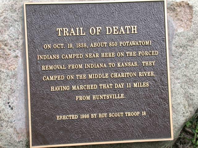
Salisbury, Missouri, beside Salisbury Scout cabin. GPS N-3925034 W-9248102. (Photo by Larry Prichard, Lynn, Indiana, on Trail of Death Commemorative Caravan, 2003.) 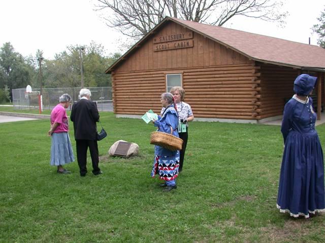
Salisbury, Missouri, beside Salisbury Scout cabin. GPS N-3925034 W-9248102. Pictured above: Teddy Tully, unidentified woman in black, Shirley Willard, local woman, Carol Layman. (Photo by Larry Prichard, Lynn, Indiana, on Trail of Death Commemorative Caravan, 2003.) 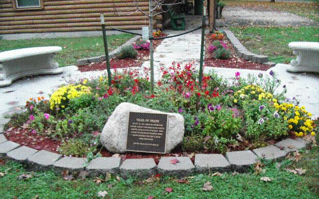
Salisbury, Missouri, beside Boy Scout cabin. GPS N-3925034 W-9248102 Located in front of Boy Scout log cabin in town park. Erected in 1998 by Boy Scout Troop 18, led by Dean Meyer. The marker has been beautified with a sidewalk, benches, edging stones and flowers. (Photo by Bill Willard, 2004) Leave Salisbury by exiting the park and going north on S. Broadway about 7 blocks. Turn west (left) on 2nd Street. Go about 5 blocks to US 24 and turn west (left) on 24, also known as 5. Head to Keytesville. |
| < Previous | Home | Next > |