|
Keytesville Upon arriving at Keytesville, 24 becomes Jackson Street. Turn north (right) on Park Street and go 2 blocks. The Trail of Death marker is on the corner of Bridge and Park streets. Saturday 20th Oct. [Traveled 11 miles from Salisbury to Grand Chariton River near Keatsville (now spelled Keytesville), Missouri.] Left Chariton encampment at 8 o’clock this morning. The road was quite muddy, and the air very cold. At 12 we reached our present encampment on Grand Chariton River, two miles from Keatsville. Tomorrow being the Sabbath we shall remain in camp.The health of the Indians is almost completely restored. There are perhaps scarcely a dozen cases in camp. Subsistence beef and flour - of which the Indians are becoming tired. Bacon and pork cannot be procured. Forage hay and corn. Sunday 21st Octr. [Keytesville, Missouri.] Today we remained in camp to allow the Indians, according to a request made by them, an opportunity for worship. During the day a considerable quantity of apples and cider was purchased and given to the Indians. The health continues good. One or two of the officers have within the last few days been much indisposed. 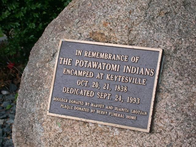
Keytesville, Missouri GPS N-3926070 W-9256230. Located in Sterling Price Park. Erected in 1993. The boulder was donated by Harvey and Juanita Grotjan, metal plaque sponsored by Kalene and Rick Summerville of Berry Funeral Parlor. (Photo by Larry Prichard, Lynn, Indiana, on Trail of Death Commemorative Caravan, 2003.) When the Trail of Death Commemorative Caravan came to Keytesville in 1993, the towns people, led by Chariton County Historical Society, had a community supper for them in the Community Center. Afterward they had a program of music and the caravan told Trail of Death history. Bill Wamego, Tulsa, Oklahoma, a member of the Citizen Band Potawatomi, recited Chief Menominee’s speech. Later he sang a song about the Cabbage Head and switched from a man to a woman by changing his voice and from a scarf to a hat. It was hilarious. 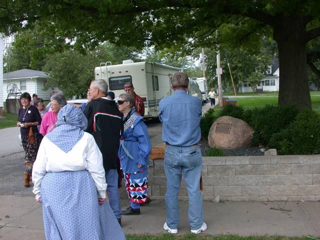
Keytesville, Missouri, in Sterling Price Park. GPS N-3926070 W-9256230. Pictured above: Mary Ann Dockery Harty, Teddy Tull, Rose Prichard (back toward camera), Bill and Shirley Willard, Joe Slavin by camper, Pat Dockery. ((Photo by Larry Prichard, Lynn, Indiana, on Trail of Death Commemorative Caravan, 2003.) Leave Keytesville by going west (left) on Bridge Street for one black, turn south (left) on Ridge Street. Go 2 blocks and turn west (right) on Jackson Street. This is US 24 and goes to Brunswick. |
| < Previous | Home | Next > |