|
Go west of Decatur on Old 36 about 6 or 7 miles and turn north (right) on CR 19 to Niantic. Enter Niantic on CR 19, turn west (left) on Lockhart Street. The Trail of Death marker is on the southwest corner of East and Lockhart streets, near the water tower. Thursday 27th Sept. [Traveled 14 miles from Decatur to Long Point, near Niantic, Illinois.] At 8 this morning we were loaded and on our horses. We traveled until 2 p.m. and reached our present camp, Long Point. During the march and for the last 3 days a considerable number of the Indian men were scouring the prairies in search of game. Their success has been such as to supersede entirely the necessity of issuing rations. The camp is full of venison. Mr. Shields, one of the Assistant Conductors, left us this morning on account of indisposition [sickness]. We find no difficulty in procuring water, and we have every reason to believe that the greater portion of our route will be found to furnish a sufficiency for the party. Physician still indisposed. Forage and subsistence the same. We find less difficulty in procuring sufficient quantities. Long Point was a “point” of trees in the prairie, south of present day Niantic, Illinois. 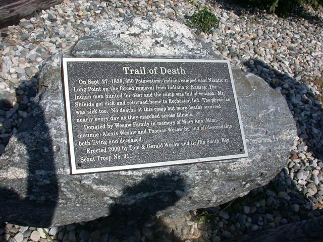
Niantic, Illinois. GPS N-3951404 W-8909858. Located in town park near water tower. Erected in 2000 by Boy Scout Griffin Smith, sponsored by Gerald and Thomas Wesaw family, Pokagon Band Potawatomi. (Photo by Larry Prichard, Lynn, Indiana, on Trail of Death Commemorative Caravan, 2003.) 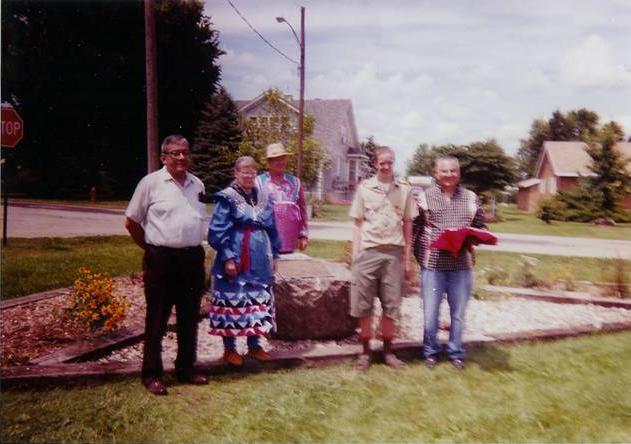
Niantic, Illinois. GPS N-3951404 W-8909858. Located in town park near water tower. Erected in 2000 by Boy Scout Griffin Smith, sponsored by Wesaw brothers, members of Pokagon Band of Potawatomi Indians. Pictured are Thomas Wesaw, Hartford, Michigan; Shirley and Bill Willard, Rochester, Indiana; Griffin Smith, Niantic, Illinois, and Gerald Wesaw, Bangor, Michigan. The marker was donated by them in memory of their grandparents, Mary Ann “Mimi-maumie” Alexis Wesaw and Thomas Wesaw Sr. and all descendants both living and deceased. (Photo by Cindy Smith, mother of Boy Scout Griffin Smith, Niantic, Illinois, July 22, 2000.) Leave Niantic by going south to the next block, Montgomery Street and turn west (right). Go on Montgomery Street 3 blocks to Broadway and turn south (left) - this takes you out of town, where Broadway becomes West Village Road and meets Old 36. Turn west (right) on Old 36. Go 4.2 miles and turn south (left) on Dye Road (also called Weaver Road, CR 21 and CR 33). Turn west (right) on I-72 (US 36) and this takes you to Springfield. |
| < Previous | Home | Next > |