|
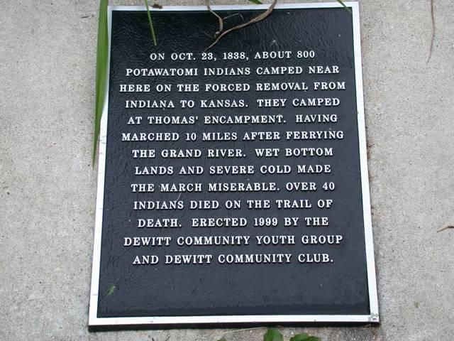
DeWitt Enter DeWitt, Missouri, by turning east (left) from US24 on Jefferson Street and go to 7th Street. The DeWitt Community Club park is on the corner of Jefferson and 7th streets. The Trail of Death marker is on the north side of Jefferson Street west of the wishing well and big iron bell. Tuesday, 23rd Octr. [Traveled 10 miles from Brunswick to Thomas’s encampment, near DeWitt, Mo.] This morning was early employed in ferrying the remainder of the wagons. By 12 o’clock all were across, and we prepared for the continuation of our journey. The bottom lands of the Missouri being too flat and wet to encamp upon an hour longer than was essentially necessary, at 1 o’clock we left Grand River encampment and passing over prairies (the cold being severe) arrived at Thomas Encampment at a little after 4, a distance of 10 miles. Subsistence beef, flour and corn. Forage corn and corn fodder. 
Located in town park on Jefferson Street. Erected in 1999 by DeWitt Youth Group led by Anita McCollum, and DeWitt Community Club. (Photo by Larry Prichard, Lynn, Indiana, on Trail of Death Commemorative Caravan, 2003.) 
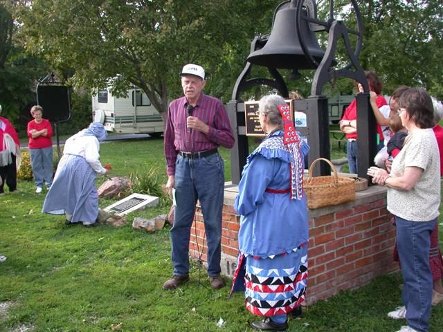
Located in DeWitt town park. Pictured are Rose Prichard placing a flower on the Trail of Death marker, Eugene Audsley whose wife heads the Carroll County Museum, Shirley Willard, and Anita McCollum. (Photo by Larry Prichard, Lynn, Indiana, on Trail of Death Commemorative Caravan, 2003.) Leave DeWitt by going west on Jefferson Street straight to US24. Turn south (left) on US 24 and go to Carrollton. |
| < Previous | Home | Next > |