|
East of Quincy on highway 104 is Mill Creek, the Trail of Death camp site for Oct. 7, 1838. Mill Creek is on the south side of the highway so travelers coming from the east will have to go to the next intersection which is 336, turn around and go back. As you head east, the Trail of Death marker is located at the entrance to a gravel pit or quarry on your right (south), just east of a race track. The road you turn on is marked Rock Quarry Road (formerly a gravel road known as 1153). Turn right off 104 (Broadway) and the Trail of Death marker is about 100 yards off the highway, on the north (right) side of Rock Quarry Road, which is now a blacktop road. If you reach the quarry, you have gone too far. Sunday 7th Oct. [Traveled 12 miles from Liberty to Mill Creek, east of Quincy. Illinois.] We were on the march this morning at half past 7 o’clock. The journey was pleasant and the road better than usual supplied with water. The distance to Quincy, of which we are now within 6 or 7 miles, was too great for one day’s journey; we therefore encamped at Mill Creek but 12 miles distance from Hobson’s Choice camp. Tomorrow we shall reach Quincy at an early hour, and as soon as possible cross the river on the opposite bank of which we expect to remain two or three days to allow the teamsters and others engaged in the service, sufficient time to repair their wagons, etc. A child died shortly after we arrived in camp. 
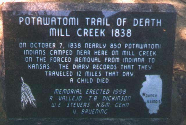
Mill Creek east of Quincy, Illinois - GPS N-3955778 W-9116962. Located on south side of State Road 104 (Broadway) at entry to Rock Quarry Road. Erected 1998. (Photo by Bill Willard, 1998.) 
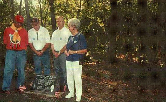
Mill Creek east of Quincy, Illinois - GPS N-3955778 W-9116962. Located on south side of State Road 104 at entry to gravel quarry. Erected 1998 by the 4 people pictured above: Rudy Vallejo, Kickapoo and Potawatomi Indian, descendant of Chief Shipshewana who was on the Trail of Death, Tom Dickinson, W. E. Stevers, and Velma Bruening - land owner. Rudy did an Eagle dance for the 2003 Trail of Death Caravan visit. He came and performed the eagle dance at the Trail of Courage Living History Festival in 2004 and 2005. (Photo by Bill Willard, 1998.) To leave Mill Creek and go to Quincy, you have to go east on the highway and turn around at the next intersection and go back west. Entering Quincy, 104 becomes Broadway. Continue on Broadway to 7th Street, turn south (left) and go 3 blocks to Maine Street. The St. Boniface Church is on Maine Street between 6th and 7th streets. The Trail of Death marker is a huge boulder beside the church facing Maine Street. |
| < Previous | Home | Next > |