|
Leaving the church, turn south (left) on 6th Street. Go12 blocks and turn west (right) on Jackson Street. Go one block on Jackson Street and turn left (south) unto 5th Street. Go block on 5th Street past Jackson Street (south). Turn right into the Indian Mounds Park. Follow the park drive around as it passes a series of Time Line panels that tell the Native American history of Quincy and area. The last one is the one that mentions the Trail of Death. 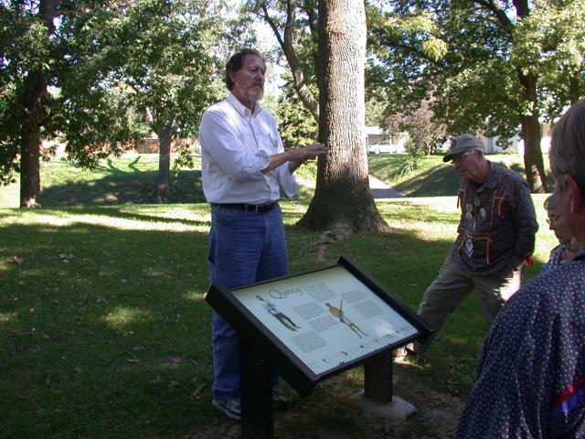
Quincy, Illinois - Indian Mounds Park. GPS N-3954933 W-9124539. This is one of the Time Line panels in Indian Mounds Park by the Mississippi River, 5th and Harrison streets, Quincy. Erected 2003 by Illinois State Museum. Pictured above is Michael Wiant of Illinois State Museum telling the Trail of Death caravan members about the history of the Indian Mounds Park. The plaque mentions the Trail of Death. (Photo by Larry Prichard, Lynn, Indiana, on Trail of Death Commemorative Caravan, 2003.) 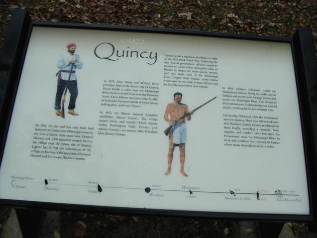
Quincy, Illinois - Indian Mounds Park. GPS N-3954933 W-9124539. Close up of panel that mentions the Trail of Death in the last paragraph at the right. It tells about Potawatomi crossing the Mississippi River there in 1838. (Photo by Bill Willard, 2004) Leave the park by going back on Jackson Street, and go 2 blocks west to N. 3rd Street (also known as highway 57 or Gardner Express Way). Go north on 3rd Street for about 16 blocks through the downtown area, turn west (left) on Broadway and go 2 more blocks. Veer left onto River Front Exit. This takes you right to the Mississippi River. Turn north (right) at the river on Bonansinga (or Riverfront) Drive between the river and railroad tracks. Go just past Cedar Street, then turn west into All America Park, on Quinssippi Road and cross over a bridge to Quinssippi Island Park. Follow the park road and turn off at the first picnic area. The Trail of Death marker is on the east (right) end next to a pavilion. |
| < Previous | Home | Next > |